
14 Places to Visit in Arunachal Pradesh by Region
14 places to visit in Arunachal Pradesh, from Tawang and Sela to Ziro, Mechuka and Namdapha, with altitude, drive times, permits and best months for each.
Shillong Trip Travel Desk · Updated · 9 min read
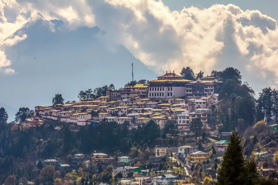 Trideep Dutta Photography · Commons · CC BY-SA 4.0
The best places to visit in Arunachal Pradesh are Tawang and its monastery, Sela Pass, Bum La and Madhuri Lake in the west; Dirang and Bomdila on the way up; Ziro Valley in the centre; and Mechuka, Pasighat, Namdapha and Mayodia in the east. Each region needs its own trip of four to seven nights.
Key takeaways
- Arunachal splits into three trips: the Tawang road in the west, Ziro and Itanagar in the centre, and the Siang, Mechuka and Namdapha belt in the east.
- Indians need a tourist eILP, now a 15-day Temporary ILP costing about INR 300–500; foreign nationals need a Protected Area Permit through an approved operator.
- Bum La and Madhuri Lake need an extra permit issued in Tawang and have been closed to foreign nationals.
- Tawang sits at about 3,050 m; sleep at Dirang (about 1,500 m) on the way up to acclimatise.
- October to November and March to May are the most reliable months; the monsoon brings landslides on almost every road.
- Distances are long: allow 25–30 km per hour of hill driving when you plan.
On this page 10 sections
Arunachal Pradesh is the largest state in the Northeast and one of the least connected, which is why "top places" lists for it mislead so easily. Tawang and Mechuka are both famous, but they are about two days' drive apart. Pick a region first, then the places.
We have grouped the state into three regions that each make one trip. Every entry gives the altitude, the distance and drive time from the nearest hub, the best months, the permit rules and a tip from our own runs. Indian citizens need a tourist eILP for every place here; foreign nationals need a Protected Area Permit. The details are in our Arunachal ILP guide.
The three regions at a glance
| Region | Places | Gateway | Nights to allow |
|---|---|---|---|
| West: Kameng and Tawang | Bomdila, Dirang, Sela, Tawang, the monastery, Bum La, Madhuri Lake, Nuranang | Guwahati or Tezpur | 6–7 |
| Centre: Papum Pare and Lower Subansiri | Itanagar, Ziro Valley | Itanagar (Donyi Polo Airport, Naharlagun station) | 4 |
| East: Siang, Shi Yomi and beyond | Pasighat, Mechuka, Roing and Mayodia, Namdapha | Dibrugarh | 6 per trip |
West: the Tawang road
1. Bomdila
Altitude: about 2,415 m · From Tezpur: 162 km, about 5 hrs · Best months: March to May, September to November · Permit: eILP / PAP · Time: 1 night
A ridge town with a Gelugpa monastery, apple orchards and a view over the Kameng hills. Bomdila is the higher of the two usual night stops on the way to Tawang, and a base for birding at Eaglenest.
Tip: nights are cold even in October; ask for a heater when you book.
2. Dirang
Altitude: about 1,500 m · From Tezpur: 205 km, about 6.5 hrs · Best months: March to May, September to December · Permit: eILP / PAP · Time: 1–3 nights
A river valley with hot springs, a stone dzong village, kiwi and apple orchards and a yak research centre up the Sangti road. Dirang is our preferred first night because it lets you acclimatise before Sela.
Tip: give it two nights if you have seniors or children in the group.
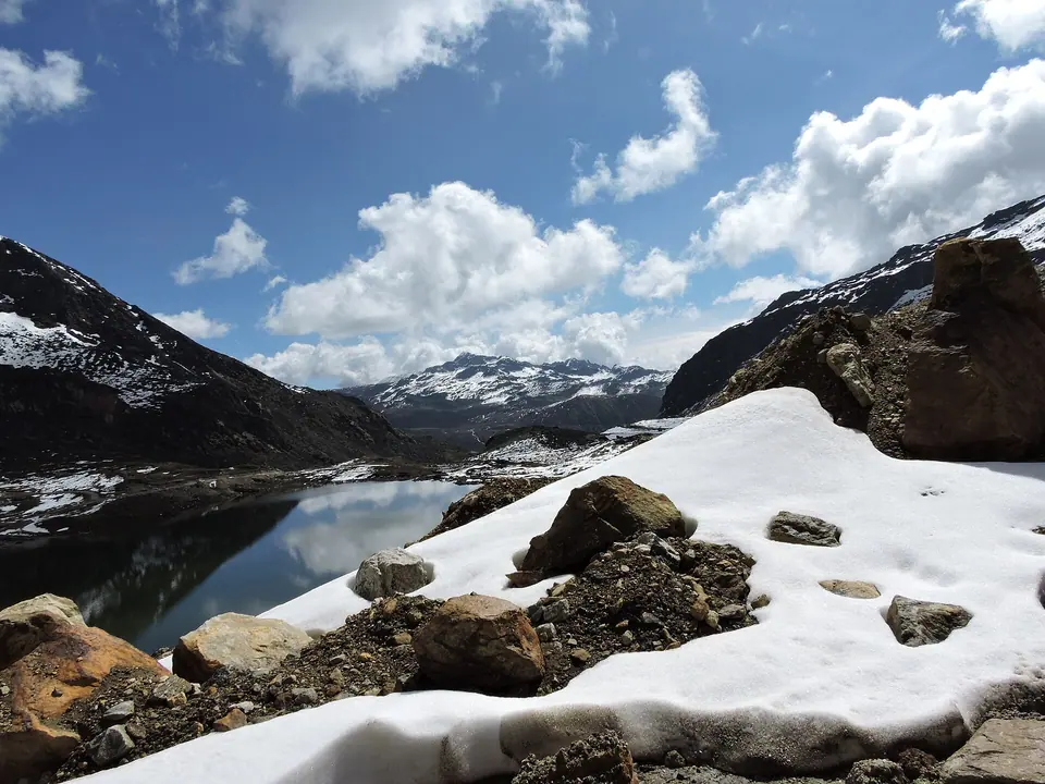
3. Sela Pass
Altitude: about 4,170 m · From Tezpur: 260 km, about 8 hrs · Best months: October to May; snow December to March · Permit: eILP / PAP, no extra permit · Time: 30–60 min
The high pass between Dirang and Tawang, with a frozen lake in winter and a memorial gate. The Sela Tunnel now carries traffic below it when snow closes the top. Our Sela Pass page explains when the old road is open.
Tip: stay no more than an hour at the top; headaches come quickly at this height.
4. Nuranang (Jang) Falls
Altitude: about 2,400 m · From Tawang: about 40 km, 1.5 hrs · Best months: April to June, September to November · Permit: eILP / PAP · Time: 45–60 min
A tall white fall a short drive off the road near Jang. Nuranang is loudest after the monsoon.
Tip: stop on the way up, when you still have energy for the path down to the base.
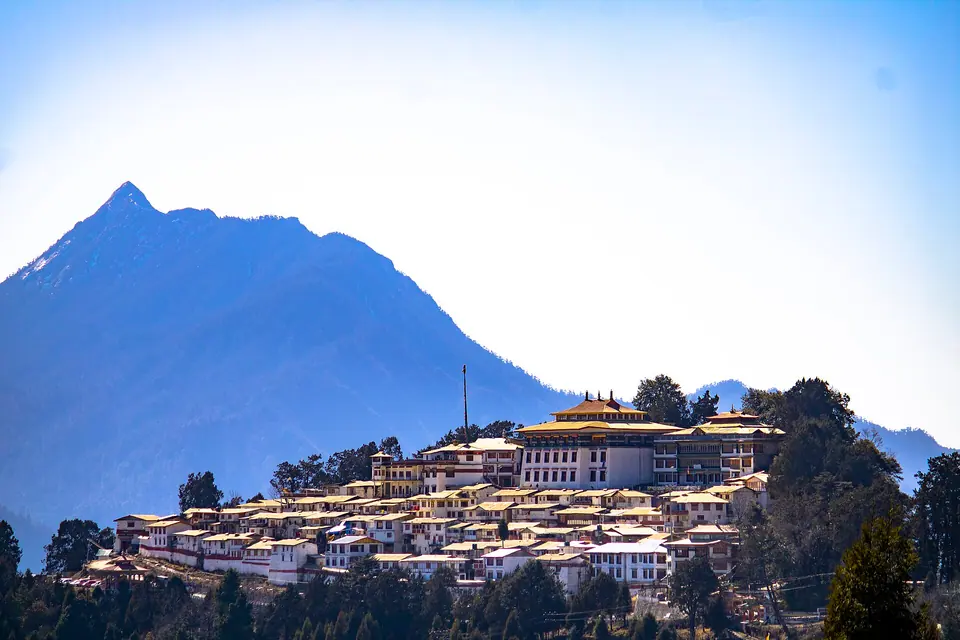
5. Tawang
Altitude: about 3,050 m · From Guwahati: about 500 km, 13 hrs of driving over two days · Best months: March to May, October to December · Permit: eILP / PAP · Time: 3 nights
The town at the end of the road, with a monastery, war memorial and markets selling Monpa crafts. Read Tawang for where to stay and what to eat, and Guwahati to Tawang for the drive.
Tip: do nothing strenuous on arrival day; start sightseeing the next morning.
6. Tawang Monastery
Altitude: about 3,050 m · From Tawang town: 2 km, 10 min · Best months: all year, snow December to February · Permit: eILP / PAP, no extra permit · Time: half a day
Founded in the 17th century and the largest monastery in India, with a three-storey assembly hall and a museum. See Tawang Monastery for timings and the prayer schedule.
Tip: reach the courtyard for the morning prayers, then visit the museum once the tour groups arrive.
7. Bum La Pass
Altitude: about 4,600 m · From Tawang: about 37 km, 2–3 hrs each way · Best months: April to May, October to November · Permit: eILP plus a special permit from Tawang, endorsed by the army; Indian nationals only · Time: full day
The India–China border pass, visited with army guidance. Bum La is often closed by snow or at short notice, so check current status before you travel. Our Bum La permit guide covers the paperwork.
Tip: apply for the permit on your first afternoon in Tawang, and hire the local taxi your hotel recommends.
8. Madhuri (Shonga-tser) Lake
Altitude: about 3,708 m · From Tawang: on the Bum La road, about 2 hrs · Best months: April to June, October to November · Permit: covered by the Bum La area permit; generally not open to foreign nationals · Time: 2–3 hrs
A lake of dead tree stumps under steep slopes, visited on the same day as Bum La. Madhuri Lake takes its popular name from a Hindi film shot here.
Tip: the army cafe by the lake serves tea and snacks; carry cash.
Centre: Itanagar and Ziro
9. Itanagar
Altitude: about 300–450 m · From Guwahati: about 330 km, 8 hrs by road; direct flights to Donyi Polo Airport · Best months: October to April · Permit: eILP / PAP · Time: 1 night
The state capital, with the Ita Fort ruins, a Buddhist gompa and the Jawaharlal Nehru State Museum. Itanagar is mostly a stepping stone to Ziro.
Tip: the museum is the best short primer on Arunachal's many tribes before you head into the hills.
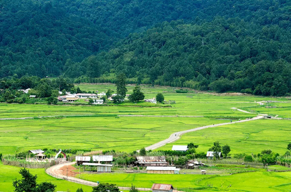
10. Ziro Valley
Altitude: about 1,500 m · From Itanagar: about 115 km, 4–5 hrs · Best months: March to May, September to November · Permit: eILP / PAP · Time: 2–3 nights
A wide valley of paddy fields and pine, home to the Apatani people, whose villages such as Hong and Hija you can walk through with a local guide. Ziro hosts a music festival in late September.
Tip: book homestays months ahead for festival week; the valley has few rooms.
East: Siang, Mechuka and Namdapha
11. Pasighat
Altitude: about 150 m · From Dibrugarh: about 100 km, 3 hrs via the Bogibeel bridge · Best months: October to March · Permit: eILP / PAP · Time: 1 night
The oldest town in Arunachal, where the Siang leaves the hills. Pasighat has river beaches, Adi villages and the Daying Ering sanctuary nearby.
Tip: it makes a sensible overnight on the way to Mechuka.
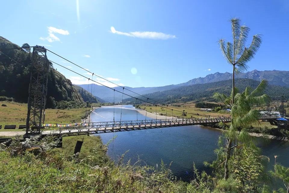
12. Mechuka
Altitude: about 1,800 m · From Aalo: about 180 km, 6–7 hrs · Best months: October to April · Permit: eILP; foreign nationals should confirm PAP coverage with their operator · Time: 3 nights
A wide valley near the border, with the Siyom river, a 400-year-old monastery and Memba villages. Mechuka takes two long days from Dibrugarh, which keeps it quiet.
Tip: carry cash; ATMs are few and often empty.
13. Roing and Mayodia
Altitude: Roing about 400 m, Mayodia about 2,650 m · From Dibrugarh: about 4–5 hrs to Roing, then 56 km to Mayodia · Best months: October to April; snow at Mayodia December to February · Permit: eILP / PAP · Time: 2–3 nights
The Mishmi hills, with lakes near Roing and a winter snow line at Mayodia pass. See Roing and Mayodia.
Tip: snow can block the Mayodia road for a day or two; do not plan a tight return.
14. Namdapha National Park
Altitude: about 200 m to over 4,500 m inside the park · From Dibrugarh: about 140 km to Miao, 4–5 hrs · Best months: October to April · Permit: eILP / PAP plus park entry at Miao · Time: 3–4 nights
A huge tiger reserve of lowland rainforest climbing to snow peaks, known for birds, gibbons and primate trails. Namdapha is for patient walkers, not quick safaris.
Tip: the rough track from Miao to Deban can be closed after rain; confirm before you set out.
Permits by place
| Place | Indian nationals | Foreign nationals |
|---|---|---|
| Bomdila, Dirang, Sela, Tawang, Nuranang | Tourist eILP | PAP via registered operator |
| Bum La, Madhuri Lake | eILP plus special permit in Tawang | Not permitted |
| Itanagar, Ziro | Tourist eILP | PAP via registered operator |
| Pasighat, Mechuka, Roing, Namdapha | Tourist eILP; park entry for Namdapha | PAP; confirm district coverage |
Under the Arunachal ILP guidelines notified in 2026, the tourist permit is a Temporary ILP valid for 15 days across the whole state, applied for online with Aadhaar authentication and costing about INR 300–500 per person; pay whatever the portal shows. A registered tour operator can apply for a group. Carry the eILP and your original photo ID to the check gate: Bhalukpong for the Tawang road, Banderdewa or Kimin for Itanagar and Ziro, and Ruksin near Pasighat for the east. For foreign nationals, the PAP is usually valid for about 30 days. Permit rules and fees change, sometimes mid-season, so check current status before you travel.
Drive times people underestimate
Arunachal's roads are better than they were ten years ago, with new tunnels, bridges and the Frontier Highway works, but they are still mountain roads. Our planning rule is 25–30 km per hour on average once you leave the plains, with more time added in the monsoon. These are the legs that surprise people most:
| Leg | Approx. distance | Realistic time |
|---|---|---|
| Guwahati to Dirang | 330–380 km | 9–11 hrs |
| Dirang to Tawang | 125–135 km | 4.5–6 hrs |
| Tawang to Bum La and back | about 75 km | 5–7 hrs with stops |
| Itanagar to Ziro | about 115 km | 4–5 hrs |
| Aalo to Mechuka | about 180 km | 6–7 hrs |
| Dibrugarh to Miao (Namdapha) | about 140 km | 4–5 hrs |
Night driving is the risk we avoid most. Fog, trucks and slides make the last hour after dark the most dangerous of the day, so we always build itineraries that arrive by sunset.
Altitude, cold and health
Only the western region takes you properly high. Tawang is about 3,050 m, Sela about 4,170 m and Bum La about 4,600 m, so mild headaches and breathlessness are common on the first day up. Sleep lower on the way (Dirang is ideal), drink plenty of water, avoid alcohol on the first night in Tawang and do not rush up stairs at the monastery. Anyone with heart or lung conditions should speak to a doctor before planning Bum La.
Ziro, Mechuka and Mayodia are lower, but winter nights in all three drop below freezing. Many guesthouses have limited heating, so pack thermals, a down jacket and a hot-water bottle from November to February.
Arunachal through the year
- March to May: rhododendrons around Sela and Bomdila, clear roads, pleasant days in Ziro. Our first choice for Tawang.
- June to September: heavy rain and landslides across the state. Namdapha's inner trails close; Tawang is possible with buffer days. Ziro's music festival falls in late September.
- October to November: the clearest skies of the year, harvest colours in Ziro and good odds for Bum La. Also the busiest period, so book early.
- December to February: snow at Sela, Bum La and Mayodia, cold nights everywhere, and the best winter light in Mechuka. Bum La closes often; Tawang town stays reachable through the Sela Tunnel on most days.
Festivals shift the calendar too. Losar in Tawang (usually February or March), Torgya at Tawang Monastery in winter, Myoko in Ziro in March and Solung among the Adi in September are all worth planning around. Dates follow local calendars, so confirm them before you book.
Respecting local customs
Arunachal has more than 25 major tribes, each with its own customs, and many villages are still deeply traditional. Ask before photographing people, especially elders and anyone at prayer. Walk clockwise around monasteries and chortens in the west. In Apatani and Adi villages, go with a local guide; they will explain which granaries, shrines and ceremonies are off limits to outsiders. Dress modestly, carry your rubbish out, and remember that the forests and lakes near the border are also military areas where photography rules are strict.
How we'd plan it
Choose one region per trip. For a first visit, take the west: two days up via Dirang, three nights in Tawang with a Bum La day, and two days down. That is our Tawang via Dirang and Sela route; Tawang with Bum La and Madhuri Lake adds a buffer for the permit.
For culture over altitude, fly to Itanagar and take the Ziro Valley trip. For the far east, our Mechuka and Namdapha trips both start from Dibrugarh. If you have close to two weeks, Grand Arunachal links Tawang, Ziro and Mechuka.
Send us your dates on our contact page and we will suggest the region that suits them.