
Permits & roads checked Shillong · Guwahati
Shillong Trip logo
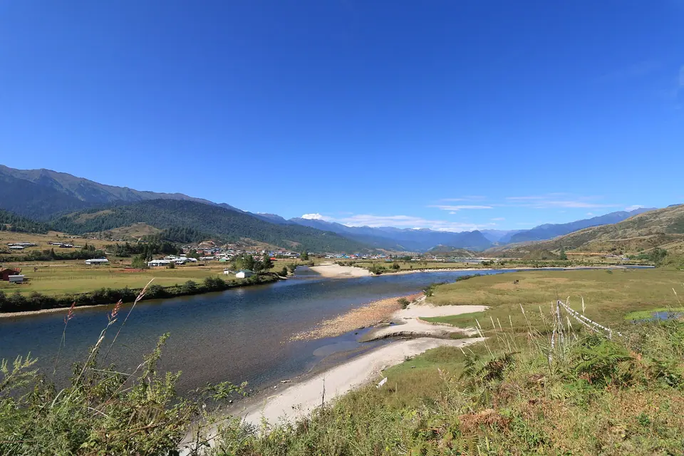
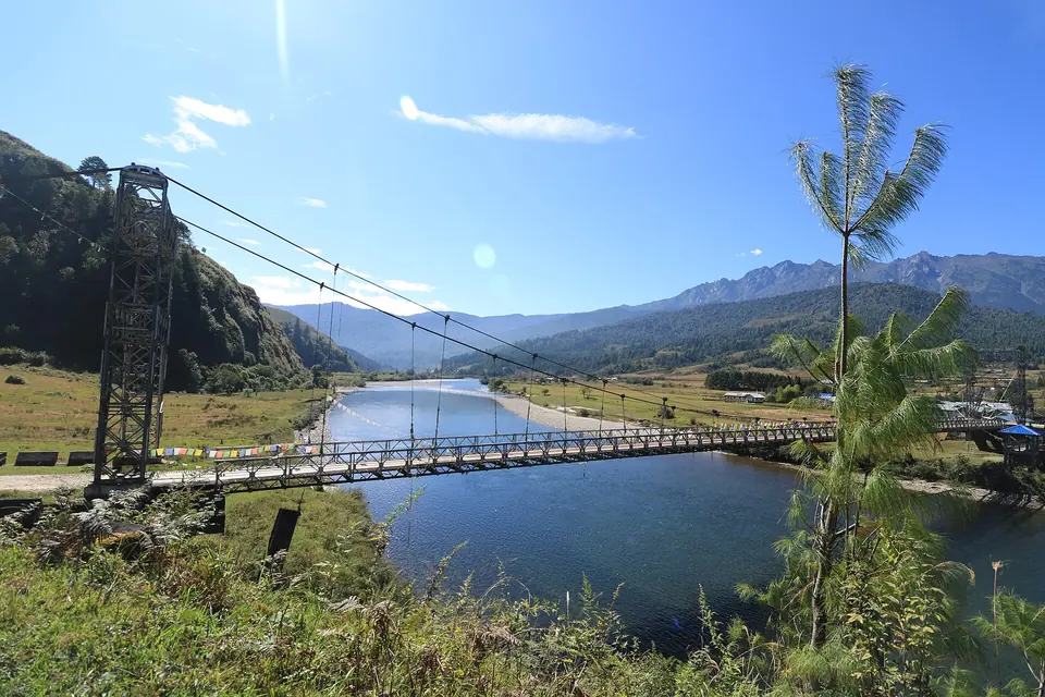
A suspension bridge over the blue Siyom river in the wide Mechuka valley under a clear skyকুমুদ ঘোষ · Commons · CC BY-SA 4.0
ArunachalShi Yomi

Mechuka

A Memba valley on the Siyom river, 29 km from the LAC

Altitude
1,900 m
Best time
Mar–May, Oct–Dec
From Dibrugarh
440 km · 14 hrs
Permit
Needed
Stay
3 nights in Mechuka, plus 1 night each way in Aalo or Pasighat
Mechuka in brief

Mechuka (Menchukha) is a valley town at about 1,900 m in Shi Yomi district, on the Siyom river and about 29 km from the Line of Actual Control. From Dibrugarh it is roughly 440 km, a two-day drive via Pasighat and Aalo. Indians need an eILP, foreigners a PAP. October to December is the best time.

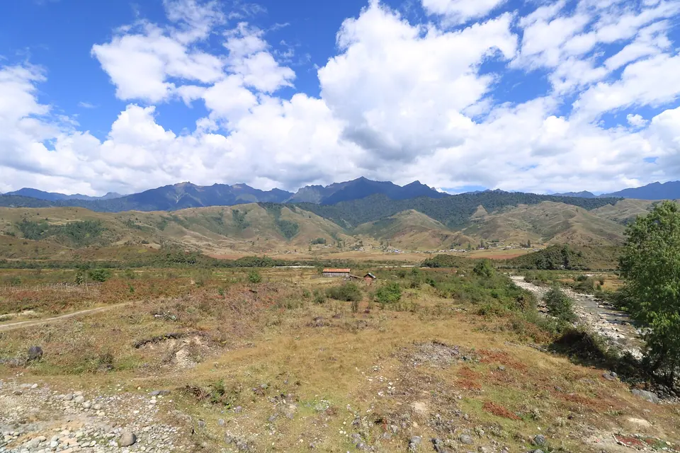
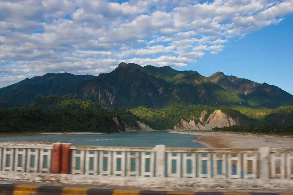
Mechuka is a long way from anywhere, and that is most of its appeal. The last 187 km from Aalo follow the Siyom river north through forest and small Adi and Tagin settlements before the valley opens out: wide grassland, a blue-green river the Memba call Yargyap Chu, wooden houses with shingle roofs, and snow peaks on three sides.

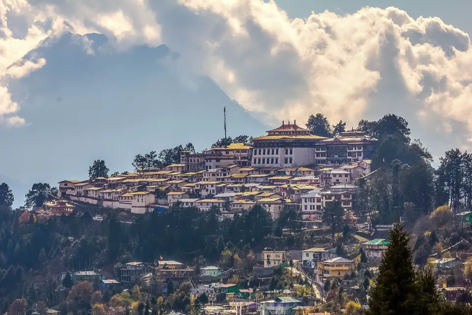
The Memba people, Tibetan Buddhists, make up most of the valley's population. Their Samten Yongcha monastery, around 400 years old, sits on a hill above town, and the Gurudwara Tapo Asthan, linked in local belief to Guru Nanak, draws Sikh pilgrims. The army is present everywhere, as the border is close.

Give it time. The drive in takes two days, and the valley's best moments, like morning frost on the meadows, walks to villages across the hanging bridges or an evening by a homestay stove, need at least three nights.

What makes it worth the trip

Samten Yongcha Monastery

A hilltop Buddhist monastery of around 400 years, with views over the whole valley.

Siyom river (Yargyap Chu)

The clear river through the valley, crossed by several suspension bridges to outlying villages.

Gurudwara Tapo Asthan

A gurudwara associated in local tradition with Guru Nanak, looked after with army support.

Memba villages

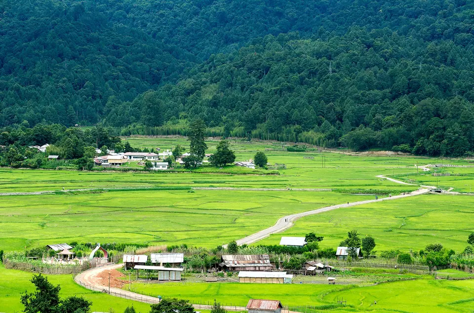
Wooden houses, prayer flags and fields around the valley, where homestays offer Memba food.

Winter peaks

Snow on the surrounding ranges from December to March, with frost on the meadows most mornings.
Things to do

  1. Walk up to Samten Yongcha monastery in the morning
  2. Cross the suspension bridges over the Siyom to nearby villages
  3. Visit the Gurudwara Tapo Asthan
  4. Stay with a Memba family and try local food and home-brewed drinks
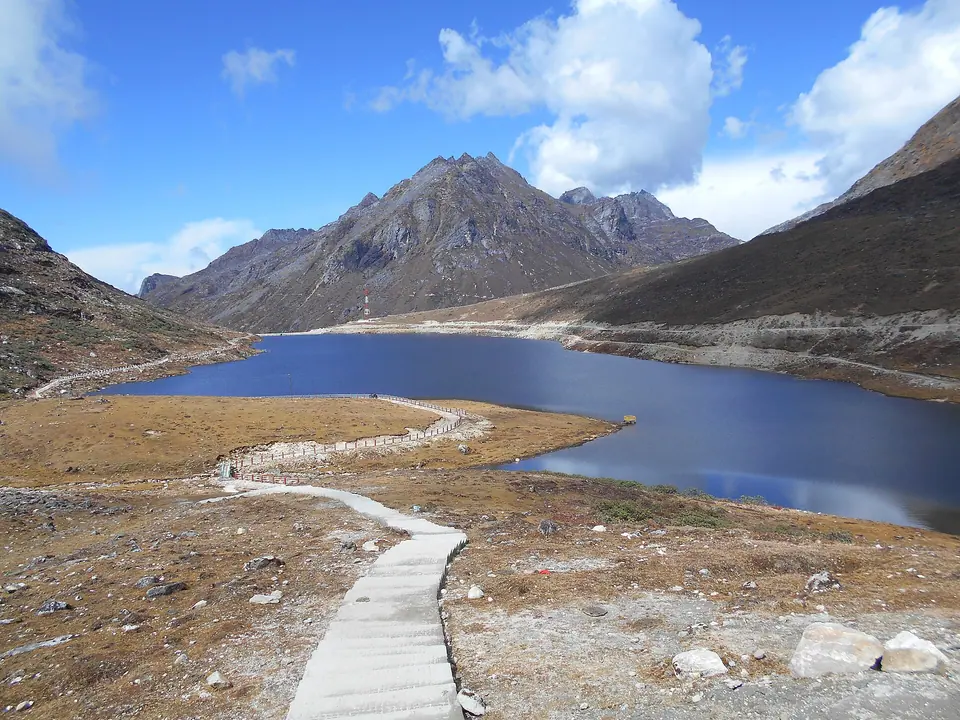
  5. Take a day drive up the valley towards the high meadows and lakes, where permitted
  6. Photograph the valley at sunrise from the ridges around town
  7. Break the drive at Aalo for the Siyom and Siang rivers and a night's rest

Getting there

From Dibrugarh, cross the Bogibeel Bridge and drive to Pasighat (about 150 km, 4 to 4.5 hours), then Aalo (about 100 km, 3 to 4 hours), and on to Mechuka (187 km, 7 to 8 hours via Tato). That is roughly 440 km over two days; we stop in Aalo. Another route runs via North Lakhimpur and Likabali. Helicopter services to Mechuka's Advanced Landing Ground are subject to operation. Landslides regularly close the Aalo–Mechuka road in the monsoon. Check current status before you travel.

Where to stay

Mechuka has no large hotels; stays are family homestays and small guesthouses in and around town, several with river or monastery views. Mountain Homestay Mechukha is one of those listed on booking platforms. Rooms are simple, with shared or basic attached bathrooms in many places, and electricity can be irregular. Heating is usually a bukhari stove or electric heater, so ask in advance for winter. Book ahead for October to December and for festival dates.

Local tips

  • Budget two travel days each way; never try Dibrugarh to Mechuka in one push
  • Fill up with fuel in Aalo; stations beyond are few
  • Carry enough cash from Pasighat or Aalo; Mechuka's ATM can be out of service
  • BSNL and Jio have the widest coverage; expect long dead zones on the drive
  • Photography near army installations is not allowed
  • Monsoon (June–September) landslides can close the road for days; check current status before you travel

Rain and weather

Rain meter: ZiroAbout 1,750 mm a year · approximate monthly averages
89J0–13°
106F2–13°
79M5–17°
169A8–19°
200M12–21°
293J15–23°
249J16–25°
232A15–25°
200S14–24°
64O10–23°
51N4–18°
14D0–16°

Source: IMD normals

October to December for clear skies and golden meadows; March to May for mild days. Snow falls on the surrounding peaks in winter.
Go with a plan

Packages that include Mechuka

ArunachalAssam

Mechuka

  1. Dibrugarh
  2. Pasighat
  3. Mechuka

From ₹31,500/person

Good to know

Mechuka: questions travellers ask

01Do I need a permit for Mechuka?

Yes. Indian citizens need the Arunachal Pradesh tourist eILP, which costs about Rs 300 to 500 per person. Under the 2026 rules a tourist permit is valid for up to 15 days across the state; the drive in and out alone takes four days, so set your dates carefully. Carry printed copies. Check current status before you travel.

02Can foreigners visit Mechuka?

Foreign nationals need a Protected Area Permit, arranged by a registered Indian tour operator, usually for groups of two or more. Mechuka lies close to the Line of Actual Control, so confirm with your operator that Shi Yomi district and Mechuka are covered before you book. Check current status before you travel, as rules change.

03How long does it take to reach Mechuka from Dibrugarh?

Plan on two days. Dibrugarh to Pasighat is about 150 km and 4 to 4.5 hours, Pasighat to Aalo about 100 km, and Aalo to Mechuka 187 km and 7 to 8 hours. Most travellers overnight in Aalo. Landslides can add hours, especially from June to September.

04Are there flights to Mechuka?

Mechuka has an Advanced Landing Ground with a runway upgraded in 2017. Helicopter services under the UDAN scheme are subject to operation, with few seats and flights that depend on the weather. There are no regular commercial flights. Check current status before you travel and have a road plan as backup.

05Does it snow in Mechuka?

The peaks around Mechuka carry snow from roughly December to March, and the valley has hard frost. Snow in the town itself is occasional, usually in January or February. The best months for clear views of the snow peaks are October to December.

06What is the altitude of Mechuka and is altitude sickness a risk?

Mechuka town is at roughly 1,900 to 2,000 m, which most people handle without trouble. The approach climbs gradually from Aalo, which also helps. Higher excursions up the valley go well above 3,000 m, so walk slowly there and drink water.

07Are there ATMs and mobile network in Mechuka?

Mechuka has limited banking, and its ATM is not always working, so bring enough cash from Pasighat or Aalo. BSNL and Jio work in town, sometimes slowly, and there are long stretches without signal on the road from Aalo. Many homestays have Wi-Fi only when power is on.

08What is the best time to visit Mechuka?

October to December is the best time, with clear skies, snow on the peaks and dry roads. March to May is also good, with mild days and greenery. Avoid June to September if you can, as monsoon landslides often block the Aalo road for long periods.

09Is Mechuka suitable for children and senior citizens?

The valley itself is gentle, with short walks and moderate altitude, but the four days of long drives on mountain roads are tiring. Fit seniors and older children who handle road travel well can enjoy it. Medical facilities are basic, so carry any medicines you need.

Still wondering? Ask a trip planner

Free trip plan

Tell us your dates, we’ll plan the route

Share when you’re travelling and who’s coming. A planner replies with a day-by-day route, hotel options and a clear price, usually within a working day.

A suspension bridge over the blue Siyom river in the wide Mechuka valley under a clear sky
Chat with us

Try “Dawki”, “Kaziranga safari” or “ILP”